Know what you have, to know what you need
The first step in setting up a GIS in any organization, large or small, is to figure out your needs. In order to figure out your needs, you need to look at what you have. This exercise is going to walk you through the different parts of your city, to see where a GIS or spatially enabled applications, may be useful.
Remember, this is a high-level, brainstorming process. While you should write down everything you can think of, you don’t want to don’t go into too much detail. Think ideas and large groupings. Layer names and attribute details will come later.
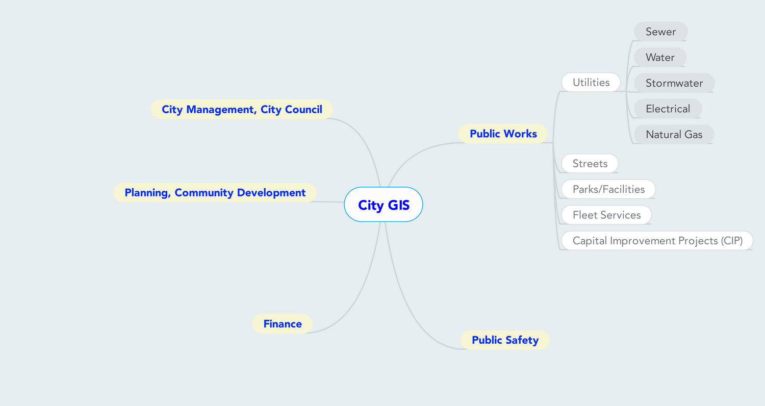
Often when I am doing this process, it helps me to map it out visually. This is something that may have been done previously using Visio. There are now online tools for Mind Mapping, that fit the bill quite well. The one that I prefer is called Mind Meister. There are many out there, so find the one that meets your needs. The benefits of mind mapping software are that they will let you make a visual map of the ideas you have, how smaller ideas grow out of them, and how they connect together.
Now, lets get started.
City-wide uses
Look at the city as a whole. You might think of these as some of your base mapping products. Some examples are the city limits, and surrounding city names and boundaries. You might also include other physical descriptors like topography and aerial photography. Finally, make sure to consider property related information.
Department-Specific uses
Now that you’ve taken the wider city view, start to think about uses within the city. Look at each department and think of responsibilities, tasks, equipment, processes, etc. that have a spatial context. Here are the primary departments that every city has:
-
Public Works: Here you will find what will likely be one of the largest users of GIS data in a city. There are many different types of facilities that have preventative maintenance and project planning functions where GIS can be a crucial element. Lets break down the department to see what uses might be found:
- Utilities – Depending on the city, utilities management represents not only one of the largest portions of Public Works, but also the largest potential for integration of spatial data. Utilities managed may include water, sewer, stormwater, electrical, natural gas, et al. Uses may run the gamut from maintenance to projct planning, to billing. Here is a great example: "How the use of GIS is growing in the municipal water/wastewaater business."
- Streets – Asset tracking is a large potential role here. From streetlights to traffic lights and signs, there are many items to track. In addition, anything related to access to streets, like traffic control plans for construction, or public events have relevance.
- Parks and Facilities – Just as with utilities, knowing where city owned buildings and other facilities are located is important for maintenance, management, and public information. Tracking of park locations and amenities serves the public, and spawns additional uses like revenue generation from facility rental. Don’t forget the frequently overlooked, but surprisingly valuable asset of city trees.
- Fleet Services – The city motor pool likely has underserved uses for spatial data. Tracking vehicle positioning and use patterns can help with planning for obtaining replacement or additional vehicles. This may also tie into asset planning when preventative maintenance is included.
- Capital Improvement Project Planning – This is generally a comprehensive effort to look at all projects being undertaken by the city. Knowing and tracking project locations may allow for economies of scale by timing projects in close vicinity to each other, or grouping smaller projects together for efficiency.
-
Planning, Community Development: Planning and zoning layers are widely used by city staff and the public. They are critical for many functions related to city planning. While these may be the primary layers for this department, there are many functions where GIS may be integrated, from layout of future development, to showing existing developments, permitting requirements, restricted areas, etc. The Los Angeles County Department of Planning, and in fact LA County in general, are heavy users of GIS.
-
Finance: Since they are all about the numbers, this is where asset management is going to become a focus. The data may be maintained by departments individually, or as a central asset management system, but eventually, the numbers need to be utilized by the finance department for valuation, assessment, and taxation purposes. Also think about any billing that the city does, for utilities, or other special districts. Incorporating a spatial component may help ensure the accuracy of billing records.
-
Public Safety: Police, Fire, Lifeguards – 911 data accuracy is a critical factor in emergency response timing. Uses range from routing to specific property access information. Think about more specific or temporal uses, like emergency access or evacuation plans during natural disasters or large public events.
-
City Management, City Council: From election districts to tracking citizen complaints, knowing where requests are coming from is low-hanging fruit to improve public perception of the responsiveness of city staff. More specific uses may include conflict of interest mapping for city council members and other elected officials.
Applications of data
The last part of this process is to look at the city and the departments in terms of what uses can be made of the data from there. Again, this is not strictly defining any application, but simply looking for ways spatial data may be incorporated, whether overtly or in the background. Here are a couple questions to ask that may help stimulate ideas:
- What tasks do staff find themselves repeating often as part of their daily tasks?
- What questions do staff find themselves fielding from the public on a regular basis?
Conclusion
As you can see from this breakdown, there are myriad ways that every city department may utilize spatial data. From city-wide informational mapping, to department specific operations and maintenance, to targeted applications for the public, the uses may be quite varied.
At the same time I list these, and you come up with others, remember that every list will be somewhat different. If there is an item that I have, that you left off, don’t feel like you need to have it.
The best implementation of a GIS for a small city is one that is tailored to the specific needs of a particular place.
Finally, don’t think you have to have every possible use listed right now. Getting the basic uses down, along with some more complex uses, will allow you to start planning your GIS schema in a more methodical way. More ideas are sure to surface as time goes on and your GIS becomes more developed. Simply add them to the appropriate area as you go along.
1 thought on “GIS for Small Cities – Step 1: Evaluating your Organization”