Get Spatial Consulting Navigation
  • Home
  • GIS Blog
  • About
  • Resources
  • Home
  • GIS Blog
  • About
  • Resources

Tag Archive

Below you'll find a list of all posts that have been tagged as “GIS Development”

GIS City Schematic

GIS for Small Cities – Step 1: Evaluating your Organization

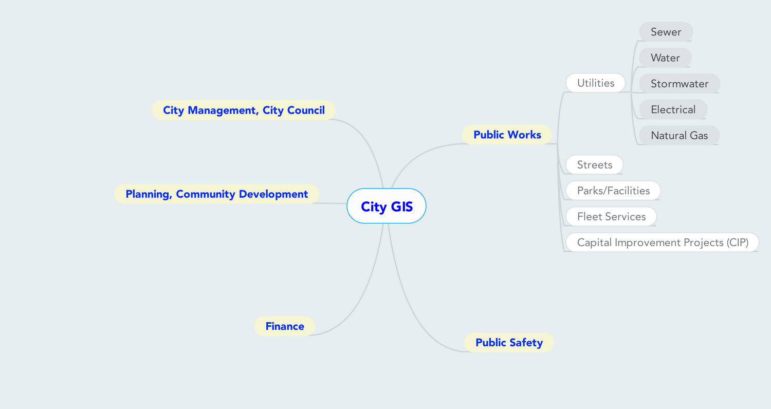
Know what you have, to know what you need The first step in setting up a GIS in any organization, large or small, is to figure out your needs. In order to figure out your needs, you need to look at what you have. This exercise is going to walk you through the different parts of your city, to see …

Read More
GIS DevelopmentPlanningSmall CitiesStructure
Follow @getspatial
[x_section class="blog_emailoptin" style=" border: 1px solid rgba(0, 0, 0, 0.075); padding: 5px;" bg_color="#bcbcbc"][x_row ][x_column type="1/1"]

But Wait, There's More!

[/x_column][/x_row][/x_section]

Popular Posts

  • QGIS – Loading Data 135 views
  • QGIS – Vector Data Connection 76 views
  • Tip of the Day – Ensure you have a Unique Identifier for each table in your database 61 views
  • Tip of the Day – Create layer definition files of standard layers for reuse and consistency 53 views
  • Tip of the Day – Use a strict directory structure for file-based data 33 views
  • GIS for Small Cities – Step 1: Evaluating your Organization 25 views
  • GIS Enabled Database Part 1 – MySQL 23 views
  • GIS for Small Cities – Step 3: Data Storage 21 views
  • The Command Line – What’s the Use? 19 views
  • GIS Enabled Database Part 2 – PostgreSQL 17 views

Categories

  • Cartography
  • Command Line
  • Data
  • Database
  • Desktop
  • General
  • Geospatial Industry
  • GIS
  • GIS for Small Cities
  • Installation
  • Open Source
  • Programming
  • Software
  • Tip of the Day
  • Uncategorized
  • Privacy Policy
  • DMCA Policy
  • Affiliate Disclaimer

©Copyright 2011-2018 - GetSpatial Consulting - Background Credit: Norman B. Leventhal Map Center at the BPL

Toggle the Widgetbar